Hydroseeding and erosion control in Hopewell
- Free estimates
- Local crews
- Erosion control and seeding
- 2 permit trigger
Get a free estimate
Tell us where the job is and we’ll get you a local quote.
By submitting this form you agree that Hydroseeding VA may share the details you provide with one or more independent local contractors, and that they and we may contact you by phone, text or email about your enquiry — including by automated dialling or prerecorded message. Consent is not a condition of any purchase and you can withdraw it at any time by replying STOP or telling the caller. Message and data rates may apply. See our privacy policy and terms.
What triggers a permit in Hopewell
Erosion control gets treated as a commercial-site problem because the federal threshold is a full acre. In Virginia it is nothing like that, and in this part of the state it is smaller again.
| Rule | Disturbance that triggers it | Note |
|---|---|---|
| Federal (EPA NPDES) | 1 acre | The number most people have heard |
| Virginia, general | 10,000 sq ft | Four times stricter than federal |
| Virginia, inside a CBPA | 2,500 sq ft | Tidewater localities only, and only inside a mapped area |
| Hopewell | 2,500 sq ft inside a mapped CBPA, 10,000 sq ft elsewhere (state minimum) | Statutory minimum — confirm with the locality |
What's different about Hopewell
Three things worth knowing before you get quotes.
A confluence city, so a lot of regulated edge
Two rivers meet at City Point and the tidal reach of the James extends past the city. Tidal shores, connected wetlands and the land immediately behind them are what the Resource Protection Area is built around, and the vegetated buffer is 100 feet where mapped. In Hopewell that is not an edge case, it is a large fraction of the shoreline.
A century of made ground
Hopewell grew around the DuPont works, which arrived at City Point in 1912 and became the largest guncotton plant in the world after 1914. Whole neighbourhoods were laid out to serve it. The practical consequence for seeding is that a great deal of ground here has been cut, filled, driven over and compacted for a hundred years, so what is under the grass is rarely native topsoil.
The flat city has one real slope
Most of Hopewell is nearly level, which lowers the erosion risk without touching the regulation. The exception is the river bluff — the houses above the James command the view precisely because the ground drops away beneath them. Bluff edges and the cuts down to the water are where erosion actually happens here, and they are the places where hand seeding reliably fails.
Recent work in Hopewell
Sandy sites that dry out, gentle ground over large areas, and stands that never filled in.
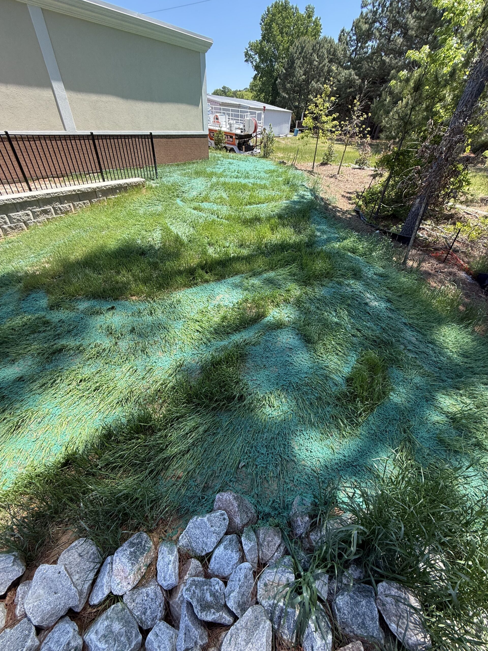
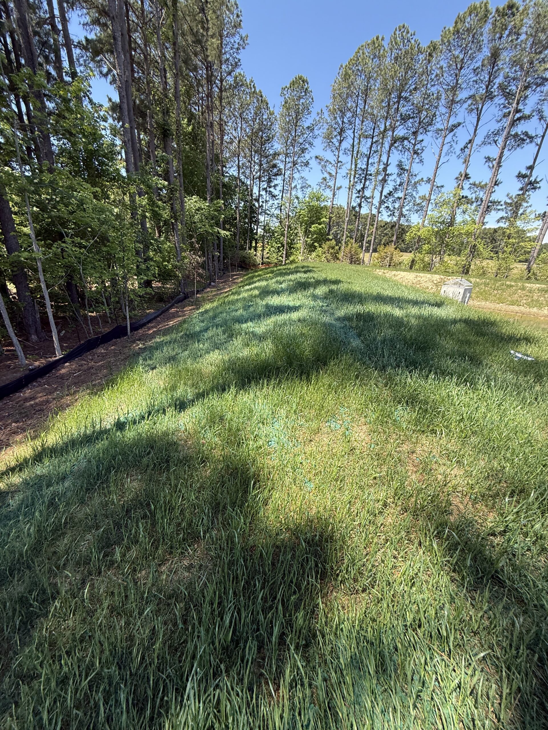
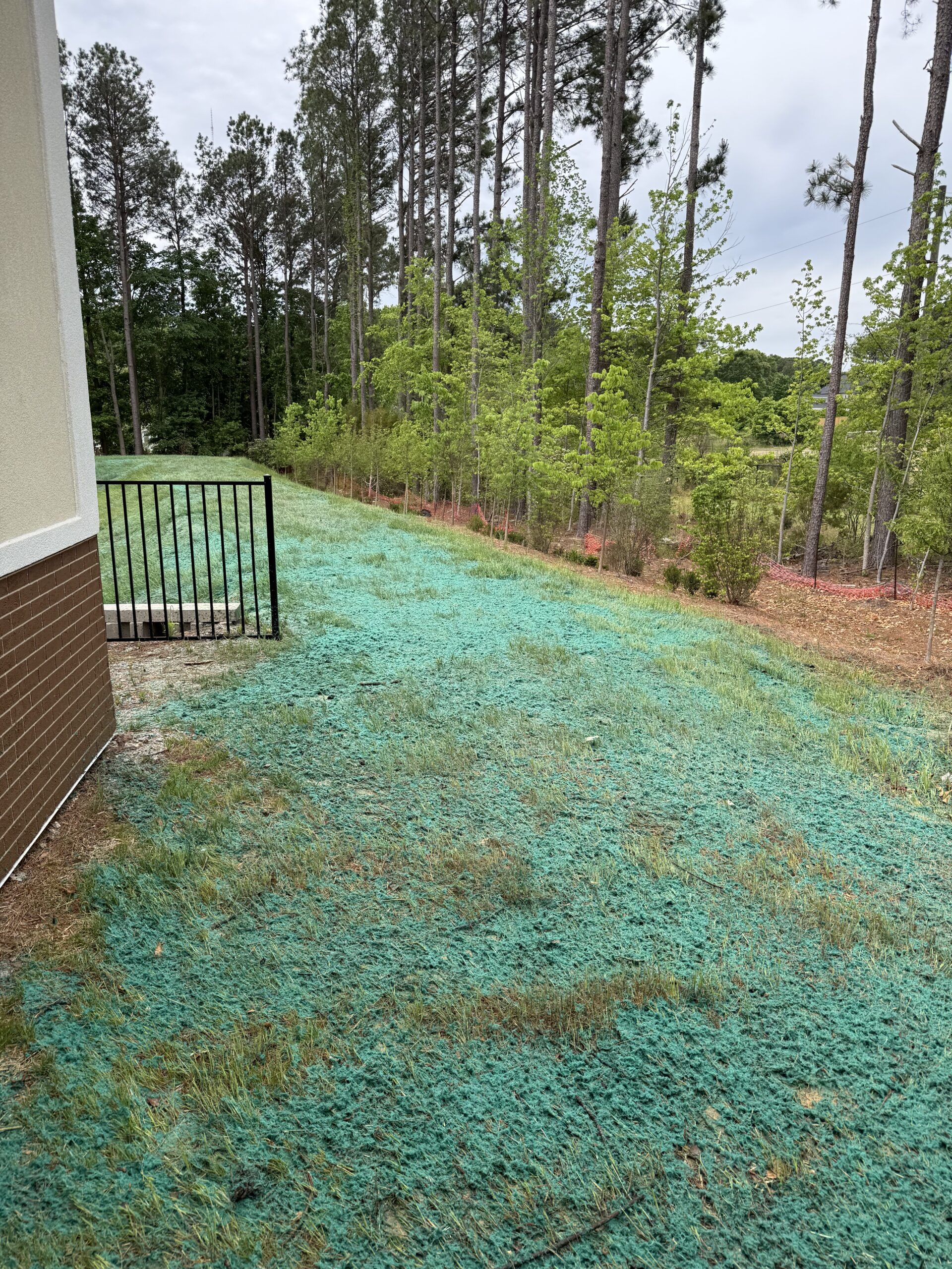
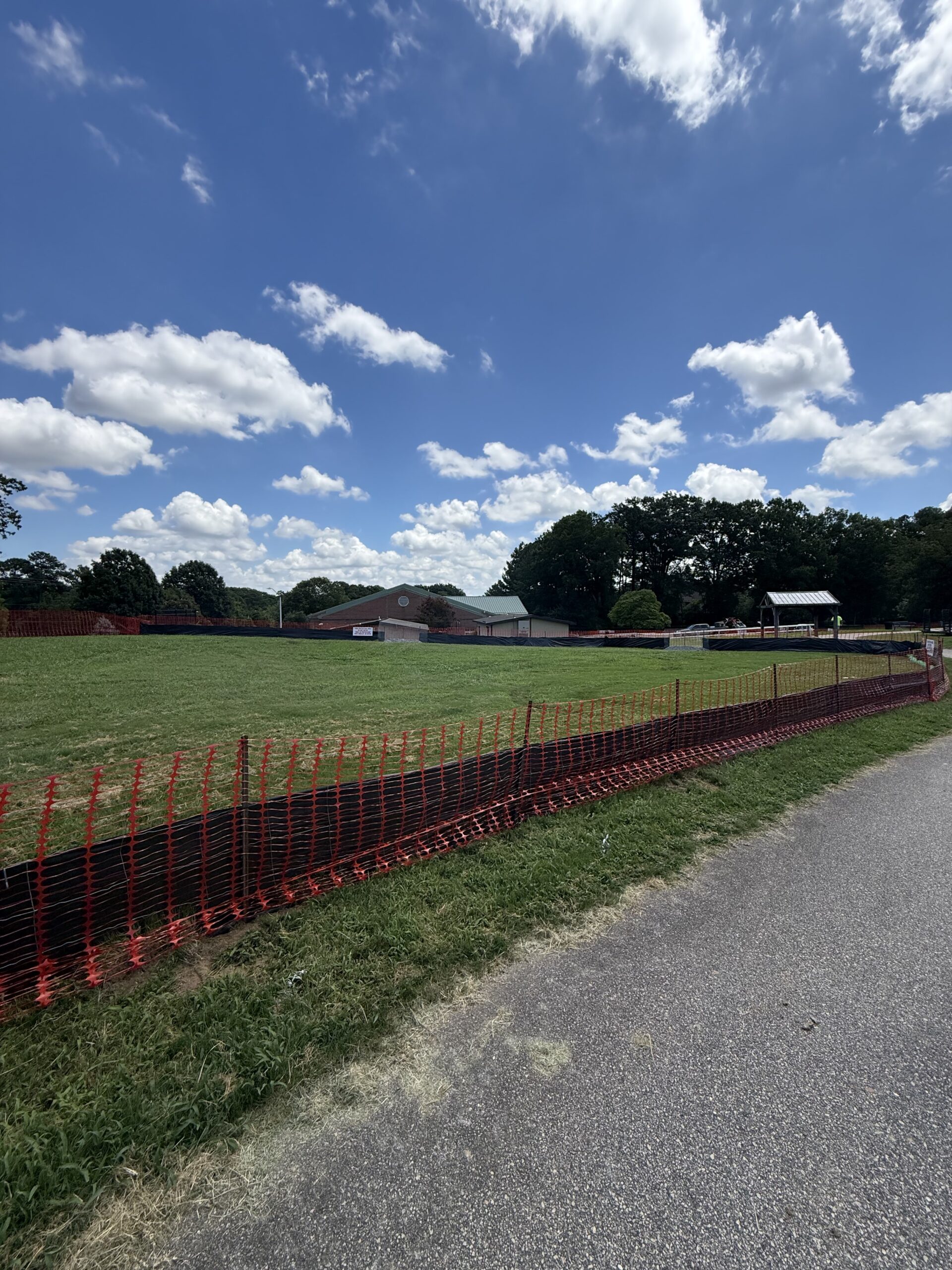
Made ground, tidal water, and one real slope
Hopewell is where the Appomattox joins the James, and the James is tidal this far up. That matters because a Resource Protection Area is drawn around tidal shores, tidal wetlands and the non-tidal wetlands connected to them — so in a city this compact, sitting on a confluence, the regulated edge is a large share of the whole. Add the 100-foot buffer behind it and a meaningful number of Hopewell properties have a plan-of-development review in front of any real groundwork.
The soil is the part most quotes get wrong. DuPont arrived at City Point in 1912 and after 1914 turned the site into the largest guncotton plant in the world; the villages that still carry their letters were laid out to house the workforce. A century of that leaves ground that has been cut, filled, driven over and compacted, and what sits under the grass in much of the city is not native topsoil. Seed sprayed onto compacted fill comes up thin and stays thin. Breaking the surface and getting organic matter into it is not an upsell here, it is the job.
The last thing is the bluff. Most of Hopewell is nearly level, which genuinely does lower the erosion risk — but the houses above the James have those views because the ground falls away beneath them. Bluff edges, and the cuts that run down toward the water, are where soil actually moves in this city. They are also exactly where hand seeding washes out and where sod creeps before it roots, which is the argument for spraying a tackified slurry onto them instead.
Bare ground to established lawn
Drag the handle. Bare Coastal Plain sand on the left, one growing season later on the right.
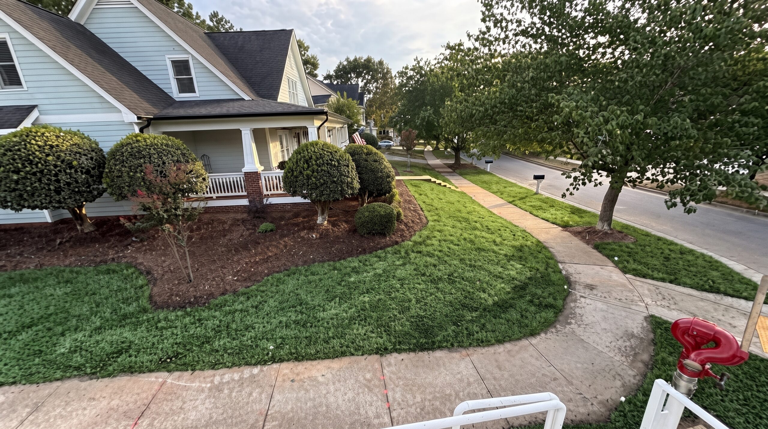
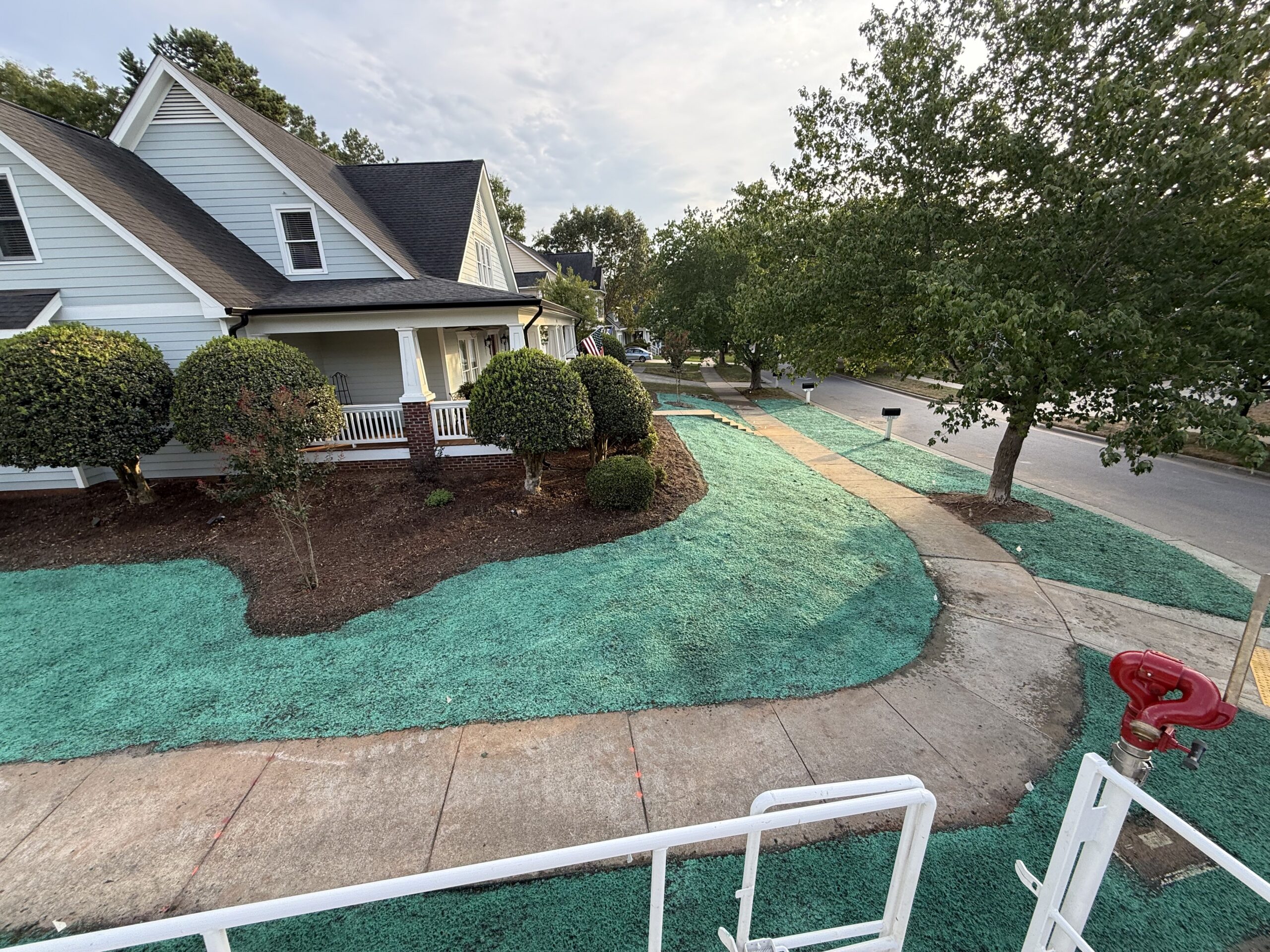 BeforeAfter — one season
Hydroseeding vs sod vs hand seeding
On sand the difference is whether the seed stays damp long enough to germinate.
| Hydroseeding | Sod | Hand seeding | |
|---|---|---|---|
| Cost per sq ft | $0.20 – $0.45 | 3 to 5 times higher | Cheapest up front, most likely to need doing twice |
| Holding moisture | Mulch mat holds water against the seed on droughty ground | Needs heavy irrigation to knit into sand | Seed dries out before it germinates |
| Gentle ground | Covers large flat areas quickly and evenly | Workable, but the cost gap widens with area | Patchy where the surface dries first |
| Sandy subsoil | Organic matter can be added with the slurry | Needs topsoil underneath to survive | Struggles without amendment |
| Grass choice | Any blend, matched to soil and light | Whatever the farm grew | Any blend |
| Usable lawn in | One growing season | 2–3 weeks | One to two seasons, patchy |
From tank to turf
Spray day in Hopewell, the fortnight after, and the result a season on.
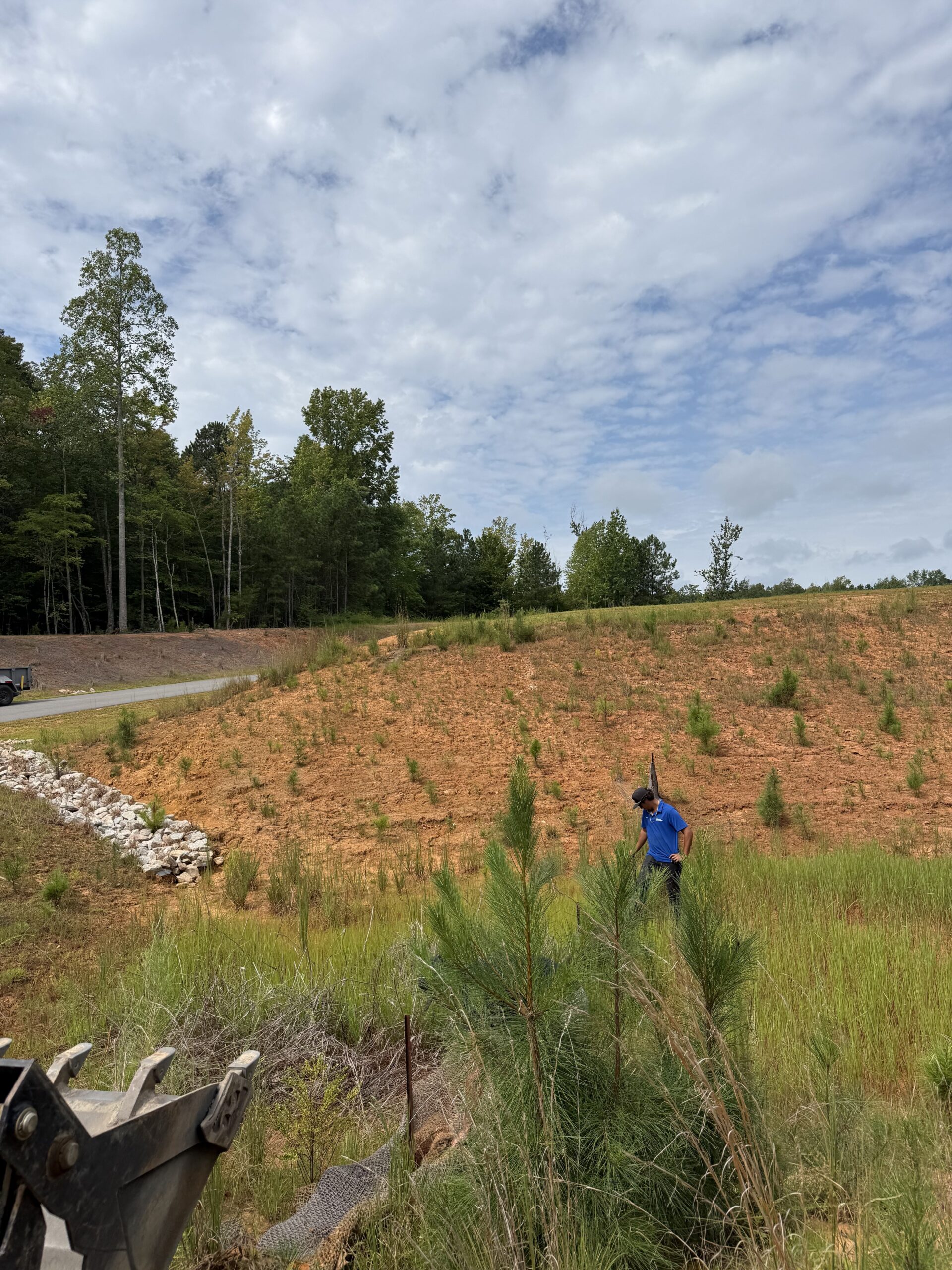
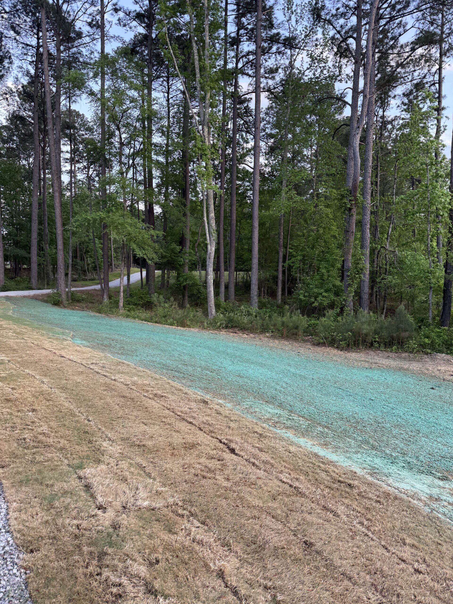
The paperwork in Hopewell
| Item | Detail |
|---|---|
| Permit | Land Disturbance Permit |
| Administered by | City of Hopewell, acting as the local VESMP authority |
| Chesapeake Bay Preservation Area | Yes — mapped areas only |
| Ground | Coastal Plain — sandy, flat, and tidal at the river edge |
| RPA buffer | 100 ft vegetated buffer where mapped |
Work we cover in Hopewell
Sandy ground changes what works. Tell us which you need and we’ll get you a local price.
Hopewell questions
The ground is flat. Do I still need erosion control?
Usually yes, for two reasons. Hopewell is a Tidewater locality, so inside a mapped Chesapeake Bay Preservation Area the trigger is 2,500 square feet with a 100-foot vegetated buffer — and gentle slopes do not exempt you from that. The second reason is the bluff: the flat city has a real drop down to the James, and that edge is where erosion genuinely happens.
My yard is nothing like topsoil. Can you still seed it?
Yes, but not by simply spraying it. Hopewell grew around the DuPont works from 1912 onwards and a great deal of the city’s ground has been cut, filled and compacted since. Seed broadcast onto compacted fill gives a thin, patchy stand. The fix is breaking the surface up and getting organic matter in as part of the same operation, which is something a hydroseeding crew can do and a sod crew generally cannot.
Does tidal water change the buffer rules?
It changes what the buffer is drawn around. Tidal shores, tidal wetlands and connected non-tidal wetlands are the features a Resource Protection Area is built on, and the James is tidal at Hopewell. Practically: the closer your work is to the water, the more likely a plan-of-development review sits in front of it, and the earlier you want to ask.
What is a Responsible Land Disturber and do I need one?
It is a Virginia certification held by an individual, not a company, required on projects where a plan or permit is needed. Because the thresholds here are small, that reaches genuinely modest residential jobs. If a contractor cannot give you a certificate number, they cannot sign your permit application.
Hydroseeding near you in Hopewell
Places we quote in Hopewell. If your address is inside the city, we cover it.
- City Point
- A Village
- B Village
- South City
- Crescent Hills
- Mansion Hills
- Davisville
- Dreamland
- Appomattox Manor
- The river bluff
Hopewell on the map
Hopewell sits east of the fall line, which is why the method here differs from the other side of the metro.
Get a free Hopewell estimate
Tell us the address and roughly how big the job is. You’ll have a real price from a local crew, usually the same day. No obligation.
Ready when you are
Tell us what the site needs and roughly how big it is. We’ll match you with a crew that works your county and get you a written price.
- Call
- (757) 936-8185
- hydroseedingva@gmail.com
- Where we work
- Richmond city, Henrico, Chesterfield, Hanover, Goochland, Powhatan and New Kent
Get a free estimate
Tell us where the job is and we’ll get you a local quote.
By submitting this form you agree that Hydroseeding VA may share the details you provide with one or more independent local contractors, and that they and we may contact you by phone, text or email about your enquiry — including by automated dialling or prerecorded message. Consent is not a condition of any purchase and you can withdraw it at any time by replying STOP or telling the caller. Message and data rates may apply. See our privacy policy and terms.